
The US National Weather Service (NWS) maintains a catastrophic flood warning for a stretch of the San Juan River between Four Corners and Mexican Hat, after several days of rain caused evacuations, rescues, and damage in the country’s Southwest. The advisory, updated on the afternoon of Sunday, October 25, reaches areas of southwestern Colorado and southeastern Utah and remains in effect until 6 a.m. local time Tuesday.
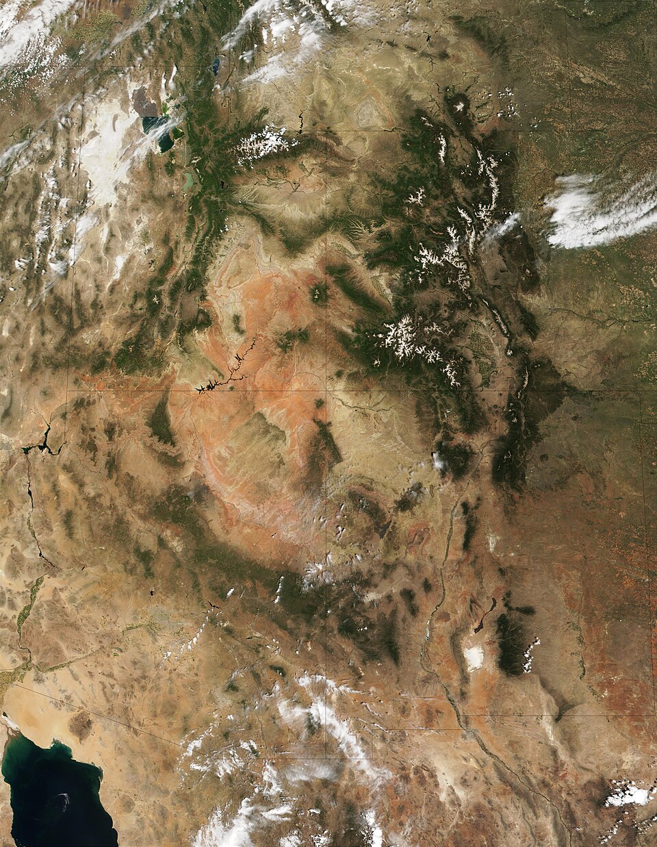
Four Corners is the meeting point of Arizona, Colorado, New Mexico, and Utah. The emergency does not affect the entire region with the same intensity: while levels of some rivers were beginning to recede in New Mexico, the NWS warned that the San Juan flooding could still worsen further downstream, especially near communities in southeastern Utah.
River could exceed flood stage near Bluff
At 1:46 p.m. on Sunday, the San Juan River measurement near Bluff, Utah, was 20 feet — about 6.1 meters. The level considered flood stage at this point is 23 feet, or approximately 7 meters. The official forecast indicated the river could reach 29.5 feet, near 9 meters, early Monday morning before falling back below flood stage on Tuesday morning.
The NWS classified the situation as an emergency and indicated risk for localities such as Aneth, Montezuma Creek, Bluff, Halchita, Tselakai Dezza, and Mexican Hat. The agency also compared the projected peak to a 32-foot flood recorded in September 1927, a historical reference that helps frame the projected volume — without implying that impacts will necessarily be identical.
In the stretch covered by this specific advisory, impacts may continue even without additional rain because water accumulated in the basins takes time to travel down the rivers. In other areas of Four Corners, however, there was still a possibility of further showers and storms, according to regional weather bulletins.
Evacuations, contaminated mud, and power outages
The Associated Press reported that days of rain forced evacuations and water rescues in the southwestern United States. In San Juan County, New Mexico, officials did not yet have an official count of damaged homes or the total number of people evacuated from their residences.
As of Sunday’s update, there were no known deaths associated with the flooding in the county. The situation, however, remained serious. The water left behind mud and sediment that, according to local administration, were contaminated by sewage following failures at treatment plants. There were also power outages, with normalization expected to take several days in certain areas.
The scale of the flooding could even be seen at local authorities’ properties: about 1.2 meters of water flooded the home of County Sheriff Shane Ferrari. Although levels were dropping in parts of New Mexico, crews and residents were still dealing with cleanup, damage assessment, and health risks.
Why the risk doesn’t end when the rain stops
The flooding is the result of a sequence of heavy rainfall events fueled by tropical moisture from the Pacific. The region had been alternating periods of heavy precipitation over approximately two months, following months of drought. Saturated soils, full river channels, and the movement of water through river basins increase the risk of overflowing even after showers end in a specific location.
The NWS Albuquerque office maintained advisories and river monitoring in New Mexico. Meanwhile, the NWS Grand Junction bulletin detailed the threat of extreme flooding on the San Juan in Colorado and Utah.
Advice is to avoid crossing any flooded area
The NWS recommends that drivers do not bypass barricades or attempt to cross water-covered roads. The depth and strength of the current can be difficult to assess, and many flood fatalities occur inside vehicles. Residents should also keep their distance from unstable riverbanks and follow local evacuation orders.
The figures and warnings in this report reflect bulletins available as of the afternoon of October 25, 2026, and may change rapidly as new river measurements are released.
Image: MODIS satellite composite of the Four Corners region, recorded on June 11, 2001. The image is contextual and does not show the current flood. Credit: Jacques Descloitres/NASA GSFC, public domain, via Wikimedia Commons.